
CIM Introduction
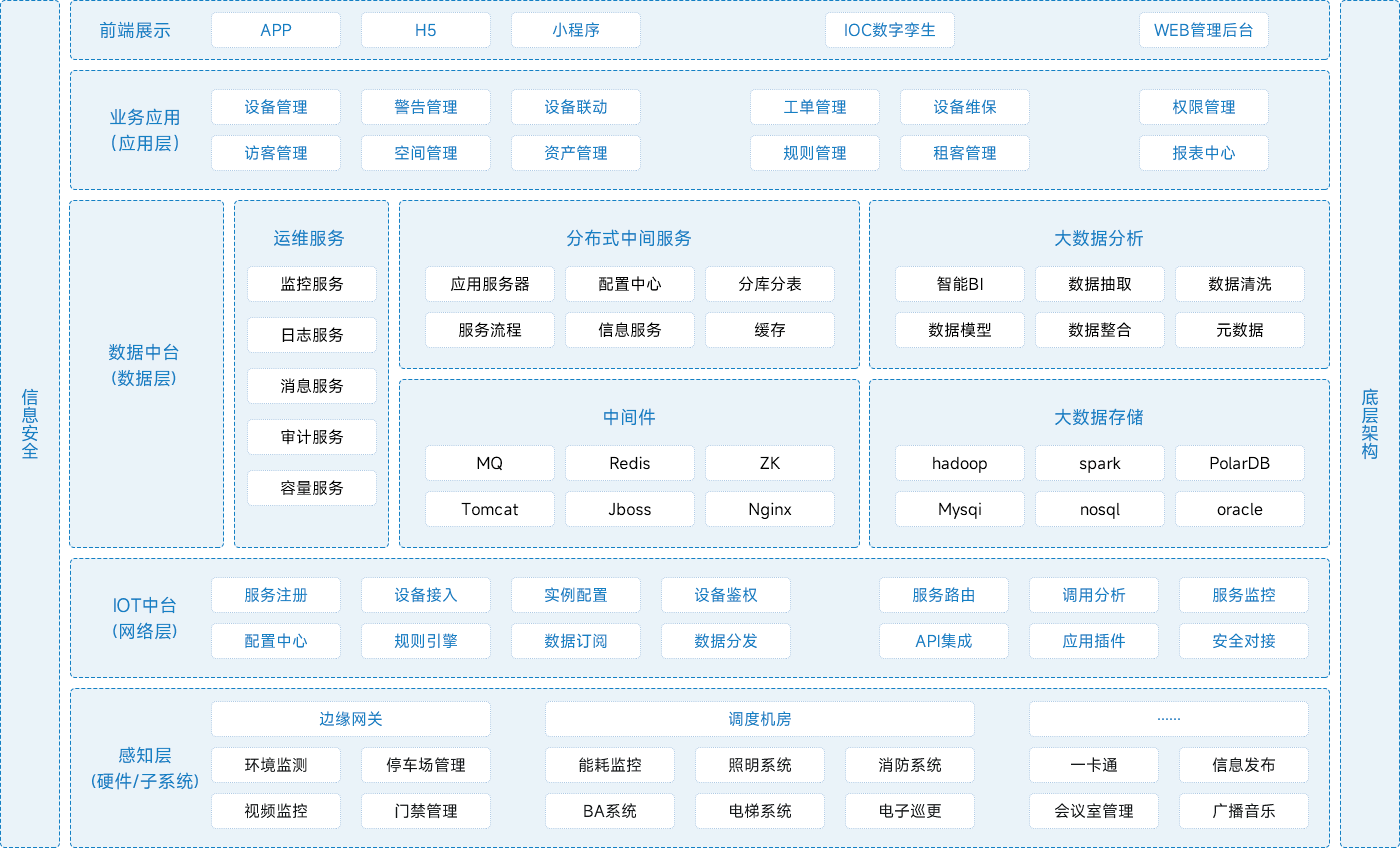
Based on the powerful data alerting, rendering alerting, and AI reconstruction engine capabilities of the PaaS layer, we achieve the aggregation, access, and fusion governance of multi-source heterogeneous data in cities. We realize unified resource management and application scenario assembly of standardized results data after governance, and achieve unified service registration and monitoring operation and maintenance management of 2D and 3D map services and scene services. We also achieve integrated visualization query and analysis of 2D and 3D data. While completing the full lifecycle management of spatiotemporal data, multiple business application scenarios in urban operation and management are supported through open API interfaces, providing cities with digital management capabilities across all spaces, elements, specialties, processes, and lifecycles.
Including connecting buildings, security/fire protection, space/assets, parking lot management, personnel visitors, employee attendance, etc. Derived from smart parks/campuses, it can be combined with smart classrooms/conference rooms, apartments, canteens, and other consumer cards. Provide unified IoT connectivity management services, establish project information models: manage sensor devices and connections, and provide linkage services for project applications.

Overall Architecture
Functional Features

High fidelity rendering
Highly realistic 3D scene rendering effects help customers better showcase data, products, and scenes in a more vivid and realistic way, thereby enhancing user engagement and decision-making effectiveness

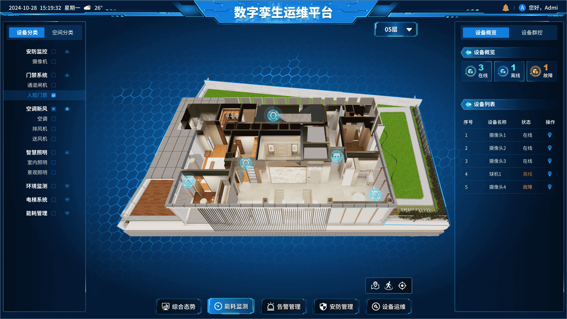
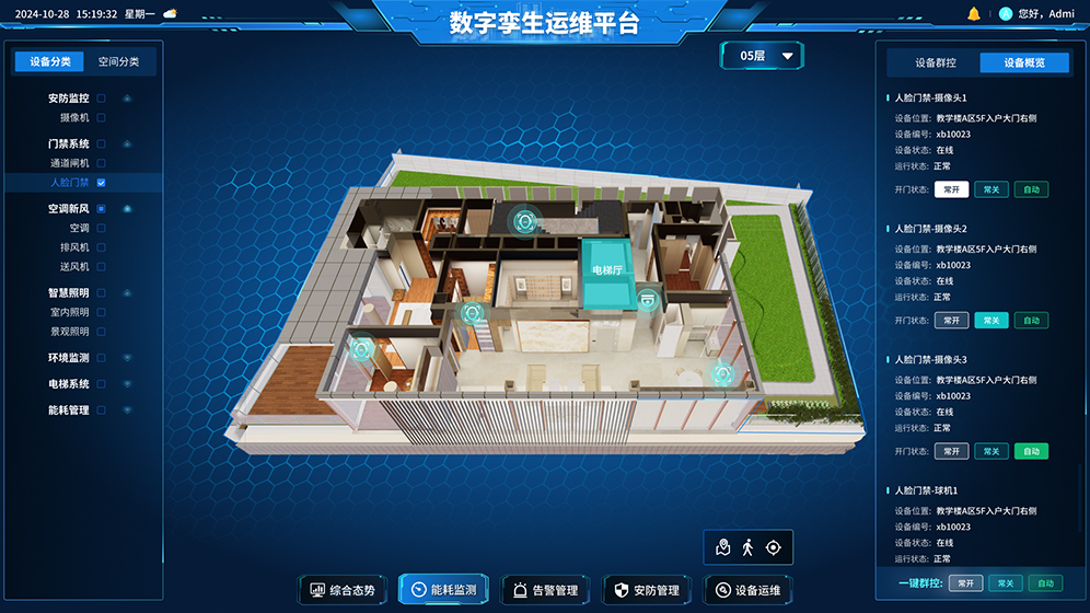
Floor layout at a glance
Detailed floor drawings delve into the floors of the building, showcasing IoT equipment, service facilities, security facilities, safety exits, etc. in detail, and keeping abreast of the operational status of IoT equipment and security facilities in a timely manner

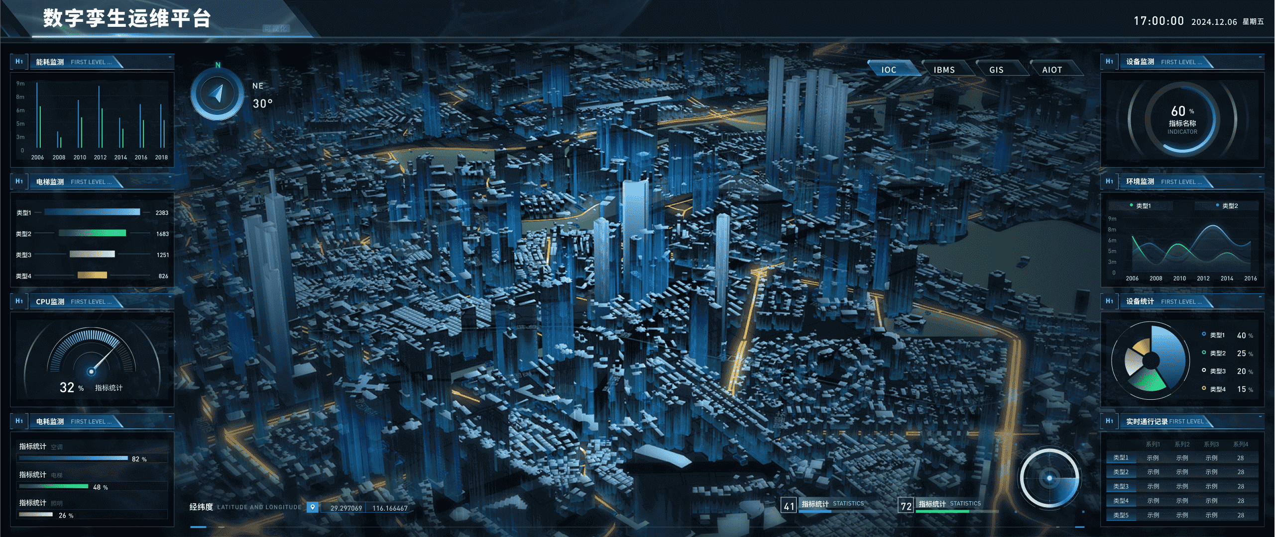
Panoramic Overview Visualization
The overall layout of the park and the surrounding transportation routes are clear at a glance, supporting 2D/3D switching, layer display and hidden, and real-time monitoring and management of line and surface quantity, which can be browsed and operated freely

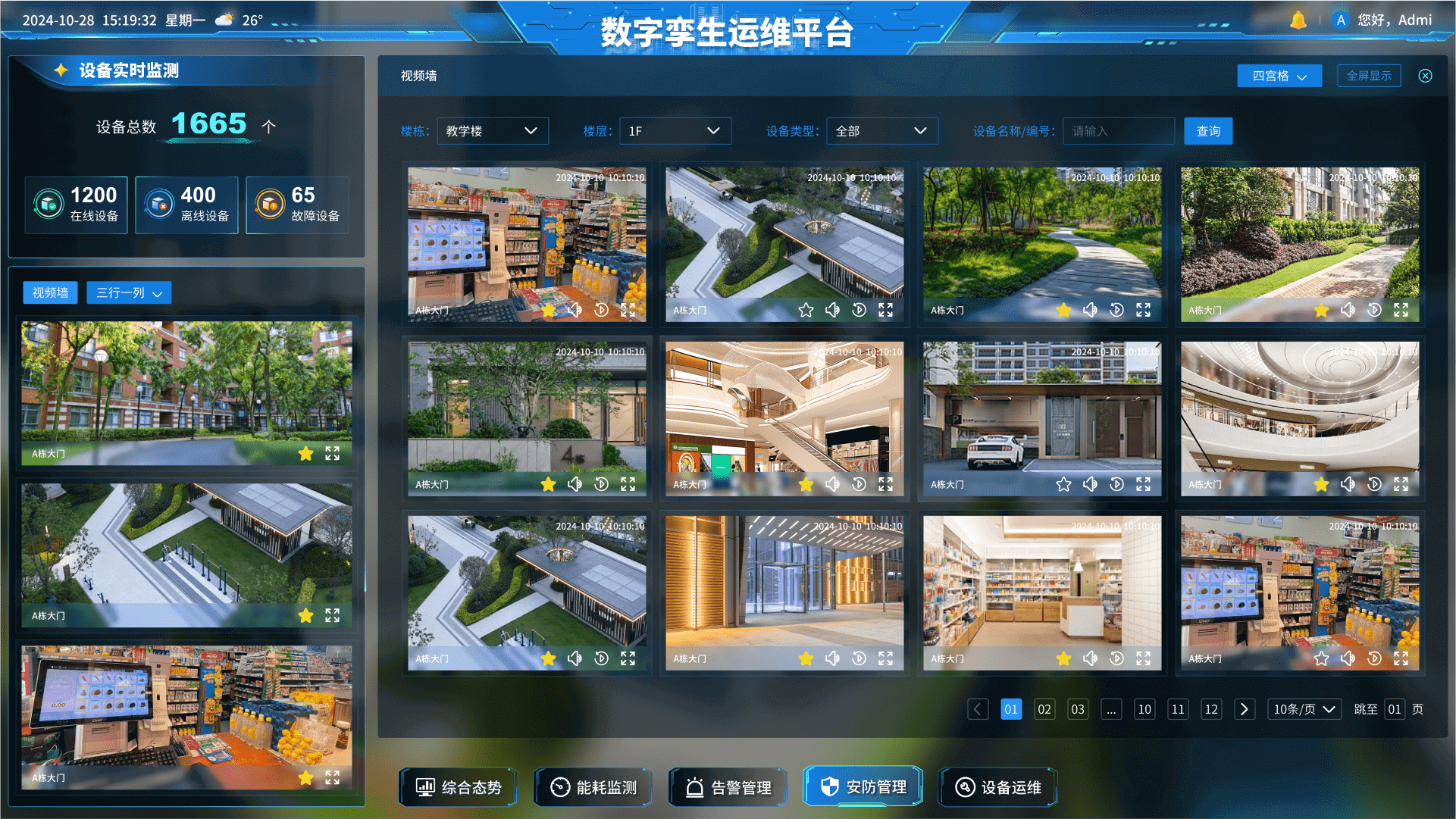
Real time and efficient device management
Real time monitoring and management of equipment, allowing for observation from any angle and distance, enabling quick positioning and obtaining detailed information of target devices, ensuring safe operation of equipment, and saving energy and manpower
Data security is controllable
By means of permission management, access control, data encryption, etc., ensure that only authorized users can access and operate data, preventing unauthorized access and operation
Twin simulation
Assist clients in predicting, optimizing, and providing decision support through digital simulations of real-world scenarios
Open sharing
By providing open and shared service capabilities through standardized SDK/API interfaces, it can be integrated with other systems and applications to achieve more efficient information sharing and collaborative work
Multi-source data fusion
Support the aggregation and access of mainstream spatiotemporal data types such as BIM, GIS, and IoT, achieving the fusion, storage, and unified management of multi-source heterogeneous data
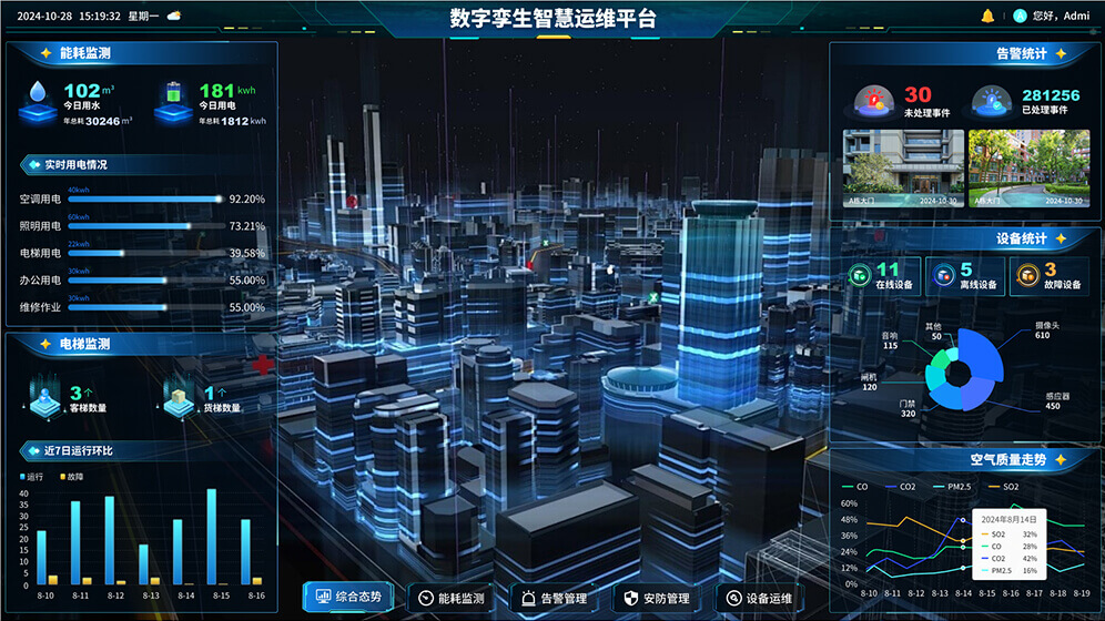
IOC Visualization
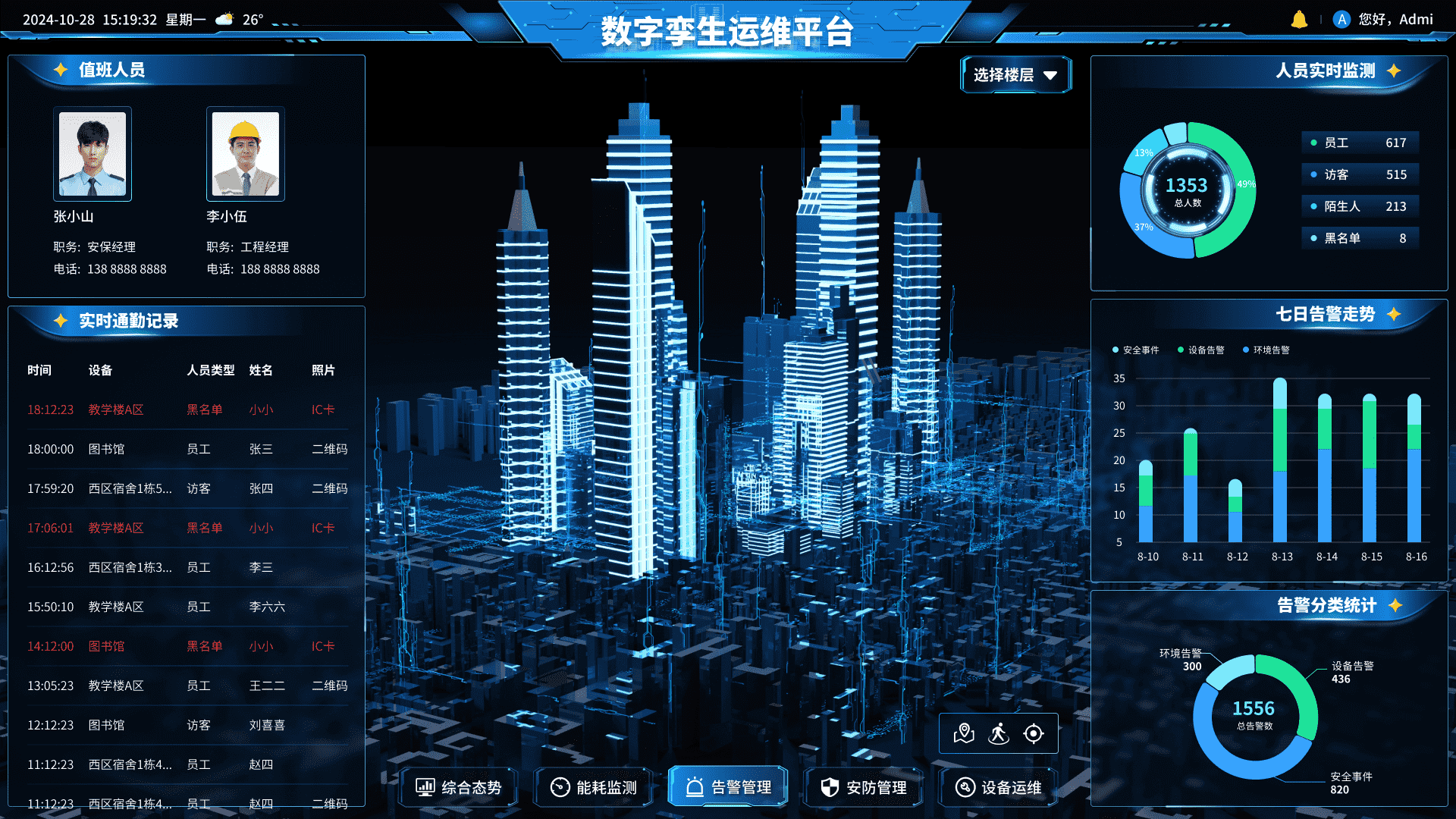
A one-stop solution for data visualization, using digital twin technology to map the physical world and monitor important indicators such as people, vehicles, objects, events, environment, and safety. It is used for operational management and decision support, empowering user business systems.
Situational awareness
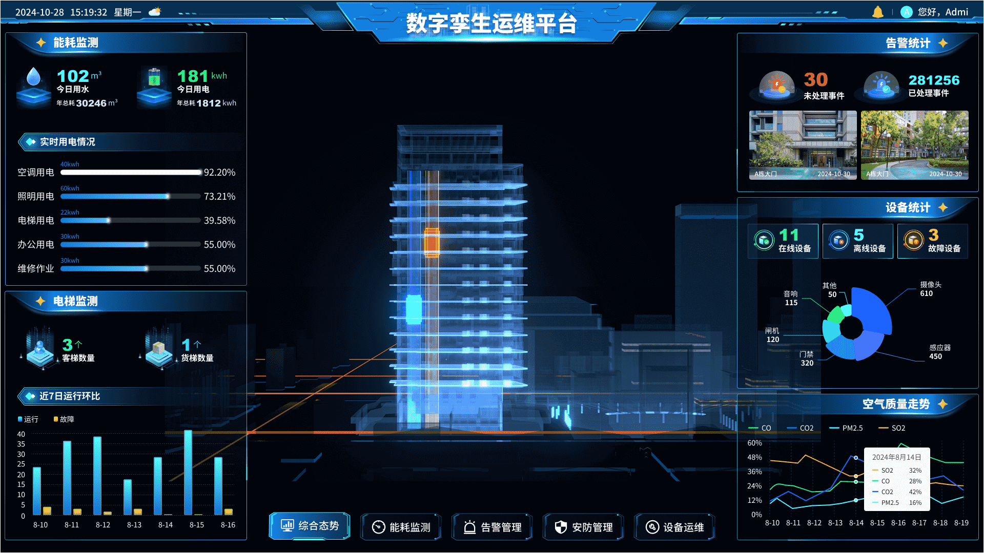
Equipment big data analysis
Visualization of Energy Data
Intelligent display of personnel information
3D digital twin

Multi scenario configuration
Natural environment simulation
Full angle 3D scene roaming
Multi source data collaboration